In this post, I will take a closer look at ArcGIS and its capabilities, including its key features and functions, different editions and tools, and how to get started with ArcGIS. Whether you are new to GIS or an experienced user, ArcGIS offers a range of tools and resources for working with spatial data and creating maps and applications.
Contents
What is ArcGIS?
ArcGIS is a software suite developed by Esri (Environmental Systems Research Institute) for creating, managing, analyzing, and displaying geographic data. It is used by businesses, governments, and other organizations around the world to map, model, and understand their data and the world around them.
ArcGIS is a powerful tool for mapping and analyzing spatial data, and it includes a wide range of features and functionality for geospatial data management, visualization, analysis, and dissemination. Some of the key features of ArcGIS include:
- Mapping and visualization: ArcGIS includes a range of tools for creating and displaying maps, including tools for styling and labeling maps, creating custom symbols and icons, and creating interactive web maps.
- Data management: ArcGIS includes tools for importing, managing, and storing spatial data in a variety of formats, including shapefiles, geodatabases, and raster datasets.
- Analysis: ArcGIS includes a range of tools for performing spatial analysis on data, including tools for calculating distances, areas, and volumes, creating buffers, overlaying data layers, and performing spatial queries.
- Collaboration and dissemination: ArcGIS includes tools for sharing data and maps with others, including tools for creating web maps and apps, collaborating with others in real-time, and publishing data to the web.
Overall, ArcGIS is a comprehensive tool for working with geographic data, and it is widely used in a variety of industries and fields, including geography, environmental science, urban planning, and more.

Editions of ArcGIS
ArcGIS is available in a range of different editions, including ArcGIS Desktop, ArcGIS Enterprise, ArcGIS Online, and ArcGIS Pro. Each edition includes different features and functionality, and is designed for different users and use cases.
ArcGIS Desktop
ArcGIS Desktop is the full-featured version of ArcGIS, and includes tools for mapping, data management, analysis, and collaboration. It is typically used by geospatial professionals, such as GIS analysts, cartographers, and geographers.
ArcGIS Enterprise
ArcGIS Enterprise is a version of ArcGIS designed for organizations that want to host their own GIS infrastructure. It includes tools for managing and hosting spatial data, creating and publishing maps and apps, and collaborating with others within an organization.
ArcGIS Online
ArcGIS Online is a cloud-based version of ArcGIS, and includes tools for creating and sharing maps and apps, collaborating with others, and accessing a range of geospatial data and services. It is designed for organizations and individuals who want to use GIS without installing any software.
ArcGIS Pro
ArcGIS Pro is a newer version of ArcGIS, and is designed to be faster and more powerful than ArcGIS Desktop. It includes many of the same features and functionality as ArcGIS Desktop, but is built on a modern architecture and includes a number of new tools and capabilities.
In addition to these core editions, ArcGIS also includes a range of specialized tools and applications for specific industries and use cases, such as ArcGIS CityEngine for urban planning, ArcGIS Insights for data analysis and visualization, and ArcGIS Living Atlas of the World for accessing global geospatial data and services.
Features of ArcGIS Online
ArcGIS Online is a cloud-based version of ArcGIS that allows users to access a range of geospatial data and services, create and share maps and apps, and collaborate with others. It is designed for organizations and individuals who want to use GIS without installing any software, and can be accessed from any device with an internet connection.
Some key features of ArcGIS Online include:
- Access to geospatial data and services: ArcGIS Online includes a range of built-in data and services, including topographic maps, satellite imagery, and demographic data, as well as the ability to add custom data and services from external sources.
- Map creation and customization: ArcGIS Online includes a range of tools for creating and customizing maps, including tools for styling and labeling maps, creating custom symbols and icons, and adding interactive elements such as pop-ups and layers.
- Collaboration and sharing: ArcGIS Online includes tools for sharing maps and data with others, including tools for creating web maps and apps that can be accessed by anyone with an internet connection. It also includes tools for collaborating with others in real-time, including tools for commenting, assigning tasks, and sharing maps and data.
- Data management: ArcGIS Online includes tools for managing and storing spatial data, including tools for importing and exporting data, creating and managing feature layers, and creating and managing geodatabases.
Overall, ArcGIS Online is a powerful tool for accessing, creating, and sharing geospatial data and maps, and is widely used by organizations and individuals around the world.
How do you install ArcGIS pro?
To install ArcGIS Pro, you will need to do the following:
- Make sure your computer meets the system requirements for ArcGIS Pro. ArcGIS Pro requires a 64-bit operating system and a minimum of 8 GB of RAM. You can find the full system requirements on the Esri website.
- Purchase a license for ArcGIS Pro. You can purchase a license through the Esri website, or through an authorized Esri distributor.
- Download the ArcGIS Pro installer. Once you have purchased a license, you will receive a link to download the ArcGIS Pro installer.
- Run the ArcGIS Pro installer. Double-click the installer file to start the installation process, and follow the on-screen instructions to complete the installation.
- Activate your ArcGIS Pro license. After installing ArcGIS Pro, you will need to activate your license to use the software. To do this, open ArcGIS Pro and enter your license information when prompted.
How do you use ArcGIS together with AutoCAD?
To use ArcGIS with AutoCAD, you will need to do the following:
- Install the ArcGIS for AutoCAD plugin:
- First, make sure you have AutoCAD and ArcGIS installed on your computer.
- Download the ArcGIS for AutoCAD plugin from the ArcGIS website.
- Install the plugin by double-clicking the downloaded installer file and following the on-screen instructions.
- Configure ArcGIS for AutoCAD:
- Start AutoCAD and open a drawing.
- In the AutoCAD command line, type “ArcGIS” and press Enter.
- The ArcGIS for AutoCAD Configuration window will appear.
- In the Configuration window, click the “Connect” button to connect to your ArcGIS account.
- If you don’t have an ArcGIS account, click the “Sign Up” button to create one.
- Use ArcGIS with AutoCAD:
- Once you have connected to your ArcGIS account, you can use ArcGIS features and functions within AutoCAD.
- For example, you can use the “Add Data” command to add ArcGIS maps and layers to your AutoCAD drawing.
- You can also use the “Query” command to search for specific features in the ArcGIS layers you have added to your drawing.
- You can use the “Geoprocessing” command to perform spatial analysis on your data, such as finding the distance between two points or creating a buffer around a feature.
What is geocoding in ArcGIS?
Geocoding is the process of converting addresses or other location-based text data into geographic coordinates (latitude and longitude). In ArcGIS, geocoding is performed using a geocoding service, which is a set of tools and data that can be used to match addresses and other location-based data to specific locations on a map.
There are two types of geocoding services in ArcGIS: forward geocoding and reverse geocoding.
Forward geocoding is the process of converting an address or place name into geographic coordinates. For example, you might use forward geocoding to convert an address like “456 Street, Anytown, USA” into a set of latitude and longitude coordinates.
Reverse geocoding is the opposite of forward geocoding, and is the process of converting geographic coordinates into an address or place name. For example, you might use reverse geocoding to convert a set of latitude and longitude coordinates into an address like “456 Street, Anytown, USA”.
ArcGIS includes a range of geocoding services that can be used to perform both forward and reverse geocoding. These services can be accessed through the ArcGIS API, or through the ArcGIS Online Geocoding Service, which is a cloud-based geocoding service that can be accessed from any device with an internet connection.
How do you get started with ArcGIS?
To get started with ArcGIS, you will need to do the following:
- Install ArcGIS: If you don’t already have ArcGIS installed on your computer, you will need to purchase a license and download the installer from the Esri website. There are several different editions of ArcGIS available, including ArcGIS Desktop, ArcGIS Enterprise, ArcGIS Online, and ArcGIS Pro. Choose the edition that best meets your needs and follow the on-screen instructions to install the software.
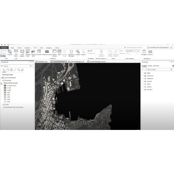
- Explore the ArcGIS user interface: Once you have ArcGIS installed, take some time to explore the user interface and familiarize yourself with the different tools and features available. The ArcGIS user interface includes a number of different panels and windows for working with maps, data, and analysis tools.
- Add data to your map: To start working with spatial data in ArcGIS, you will need to add data to your map. ArcGIS supports a wide range of data formats, including shapefiles, geodatabases, raster datasets, and more. You can add data to your map by using the “Add Data” button in the ArcGIS user interface, or by dragging and dropping data files onto your map.
- Explore the mapping and analysis tools: Once you have added data to your map, you can start exploring the different mapping and analysis tools available in ArcGIS. These tools include a range of features for styling and labeling maps, creating custom symbols and icons, performing spatial analysis, and more.
- Share your maps and data: ArcGIS includes a range of tools for sharing maps and data with others, including tools for creating web maps and apps, collaborating with others in real-time, and publishing data to the web.
I hope this provides a more comprehensive overview of ArcGIS and its capabilities. Please let me know if you have any other questions.